


International Symposium on
Drylands Ecology and Human Security

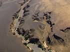
GIS and Remote Sensing One third of the continental Earth is covered by arid and semi-arid lands. They include the deserts and their semi-arid and sub-humid dry margins, and also the subtropical Mediterranean latitudes. These landscapes provide important land resources for adapted agricultural production and grazing systems. Therefore it is important to monitor the state of the environment in areas considered at risk. This is more and more important in the context of global climate change and worldwide desertification dynamics. These problems are summarized and have led to the ratification of the UN Convention to Combat Desertification (UNCCD). This convention emphasizes the need to assess land degradation and desertification processes. Remote sensing data can be used to measure bio-geochemical and bio-geophysical variables to detect land degradation processes in semi-arid geographical areas. Degradation often induces changes in surface properties as impacting the type, abundance and density of vegetation cover. Many of these changes are detectable by remote sensing through the derivation of land surface variables (e.g. LAI, PAR, fPAR, etc.). The quantitative surface parameters determined with the remotely sensed data can be incorporated into erosion and dryland degradation models (RS / GIS integration). The session gives an overview about remote sensing and GIS techniques for drylands assessment and should deal as a platform for new interdisciplinary projects. Topics of the session: Please send your abstracts and questions to Prof. Dr. Martin Kappas Download your PDF version of this session here |
|
|
|
Prof. Dr. Martin Kappas
Prof. Dr. Michel Tchotsoua |
© 2006 NDRD Imprint Disclaimer